Pacific Coast Highway 5-Day Road Trip (San Francisco to Los Angeles)
Drive Highway 1 south from San Francisco to LA over five days, through Monterey, the 17-Mile Drive, Big Sur, Hearst Castle, and Santa Barbara. Here is the route, the pacing, and where to sleep each night.
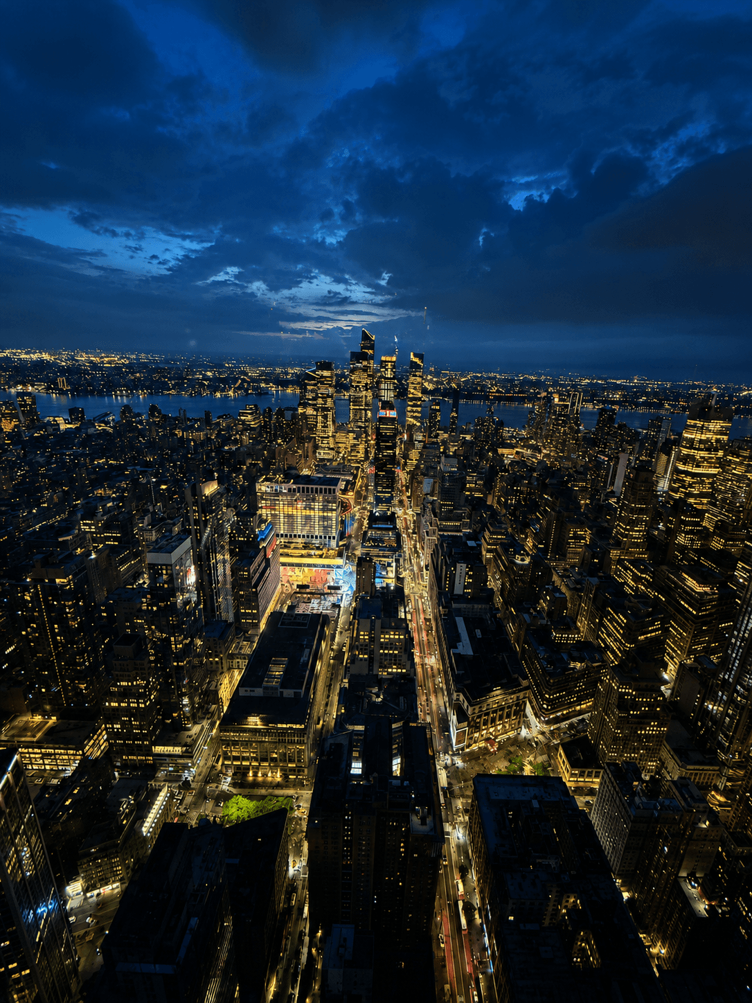
trablog 큐레이션·5 days·21 places
The Pacific Coast Highway from San Francisco to Los Angeles is the California road trip everyone pictures, and five days is the sweet spot for a first drive. Long enough to slow down through Big Sur, short enough that you are not living out of the car for two weeks. You will cover roughly 500 miles of Highway 1, but the mileage is not the point. This stretch is slow on purpose, full of cliffside curves and pullouts you will want to stop at.
This plan runs north to south, and that direction matters more than people expect. Driving south puts you in the right-hand lane on the ocean side, so the views are right out your window and the scenic pullouts are easy to swing into without crossing traffic. It is a point-to-point route, San Francisco at one end and LA at the other, so you are always moving forward and never doubling back.
A few things up front. Big Sur is the centerpiece, and it is also the slowest part of the drive, so the pacing here gives it room instead of cramming it between two long hauls. Not every famous stop earns the same amount of your time, and this guide says which ones are worth the detour and which are a quick photo. And one piece of planning you cannot skip: Highway 1 through Big Sur closes for landslides more often than any other road in the state, so you will want to check current conditions before you leave. More on all of that below.
DAY1
San Francisco to Monterey (Half Moon Bay, Santa Cruz)
Get out of the city and onto the coast. Today is the easy opener: roughly 120 miles of Highway 1 south to Monterey, with a couple of beach-town stops to break it up. No big hikes, just easing into the rhythm of the drive.
TIP
Leave San Francisco by mid-morning to beat the worst city traffic. The full Highway 1 route to Monterey runs around 3 hours of pure driving, closer to 5 or 6 with stops, so do not over-schedule day one. Fill the gas tank before you leave the city.
Your first real stop, about 45 minutes south of the city. It is a low-key coastal town with a long state beach and a walkable main street, and it makes a good first stretch-your-legs break before the longer drive ahead. Grab coffee or an early lunch and walk the bluff. From here it is roughly an hour down to Santa Cruz
A classic seaside amusement park right on the sand, the kind of old-school boardwalk with a wooden roller coaster and a Ferris wheel over the water. It is fun for families and good for a photo, but you can see the gist in 30 to 45 minutes. If you are short on time or traveling without kids, the boardwalk is easy to skip in favor of just walking the beach. Monterey is about another hour south.
Roll into Monterey by mid-afternoon and check in. Cannery Row is the old sardine-canning waterfront from the Steinbeck novels, now a walkable strip of shops, seafood spots, and the aquarium (which you will do properly tomorrow). Settle in, walk the waterfront at sunset, and have an easy first dinner here. This is your base for two nights.
DAY2
The Monterey Peninsula (Aquarium, 17-Mile Drive, Carmel, Point Lobos)
A short-distance, big-payoff day with almost no long driving. You will see one of the best aquariums in the country, cruise the famous 17-Mile Drive, wander the storybook village of Carmel, and finish at the coastal reserve everyone calls the crown jewel of California's parks.
Start with the standout. This is widely considered one of the best aquariums in the world, built right into the old cannery on the bay, and the kelp forest tank and sea otters alone are worth the visit. Go at opening to beat the school groups, and check the daily feeding schedule when you walk in. Give it two hours. It is right on Cannery Row, so you can walk from most Monterey hotels.
A scenic private loop through Pebble Beach, with marked stops at cypress-lined coves and the famous Lone Cypress clinging to its rock. You pay per car at the gate and follow a self-guided route, which takes about an hour if you stop at the highlights. The two pullouts worth the stop are the Lone Cypress and Spanish Bay. It connects neatly into Carmel at the south end.
A tiny, walkable village of fairytale cottages, art galleries, and white-sand beach, right where the 17-Mile Drive lets out. The village itself is the real draw, not just the beach: wander Ocean Avenue and the hidden courtyards, grab lunch, and poke into galleries. Park once and explore on foot. Easy to spend a couple of relaxed hours here.
Just south of Carmel, this is the coastal reserve people call the crown jewel of the state park system, and it is the right note to end the day on. Short, flat trails along the headlands give you turquoise coves, sea lions, and often sea otters offshore. The Cypress Grove and Sea Lion Point loops are both under an hour. Parking inside the reserve is limited and fills up, so arriving later in the afternoon helps. Then it is back to Monterey for your second night.
DAY3
The Big Sur Coast (Bixby Bridge, Pfeiffer Beach, McWay Falls)
The heart of the whole trip. Today you drive the cliff-hugging stretch of Highway 1 through Big Sur, the part everyone comes for. It is only about 30 miles of road, but it is the slowest 30 miles of the drive, full of curves, pullouts, and reasons to stop. Plan for a short driving distance and a long day.
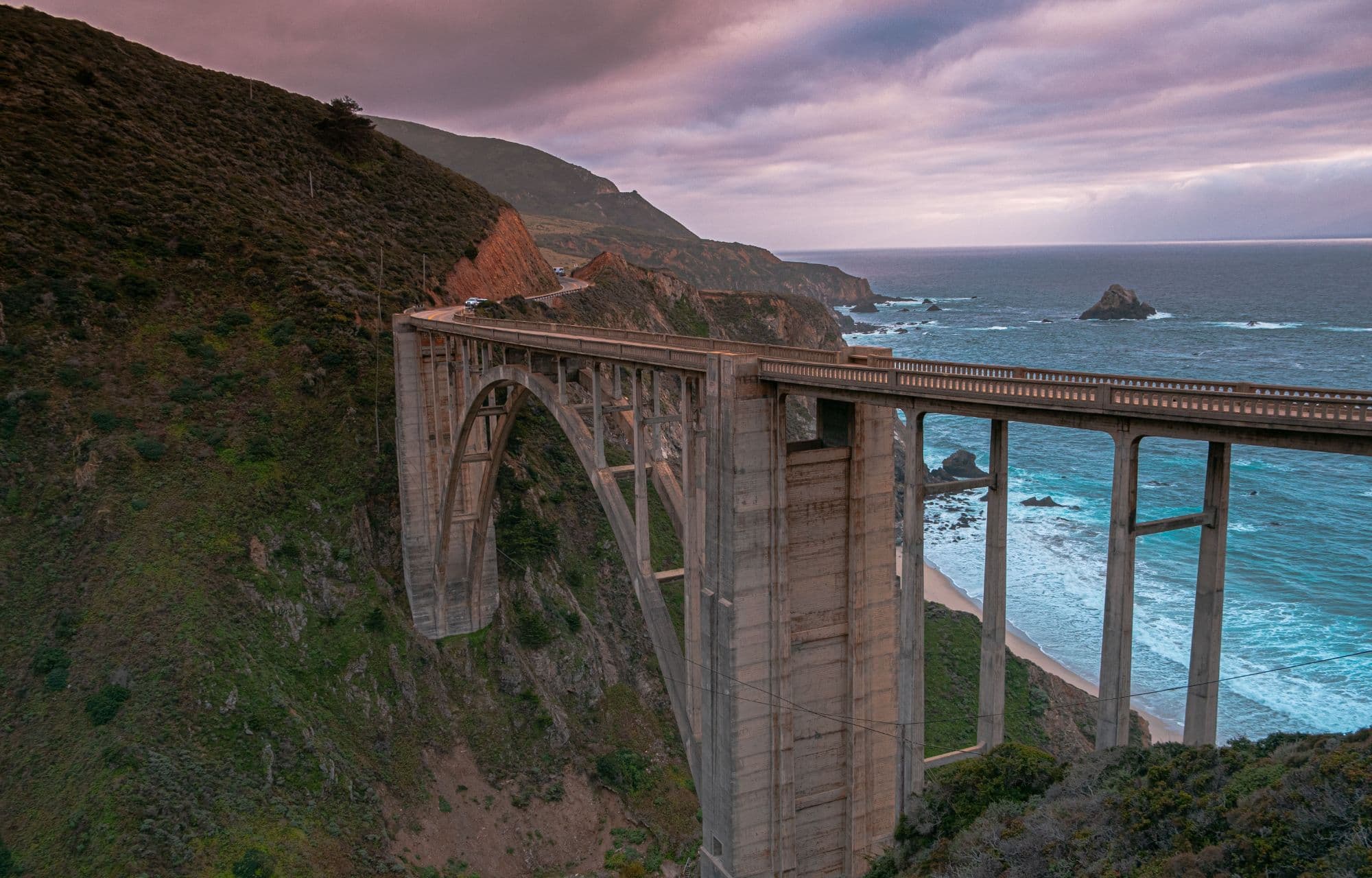
The most photographed bridge on the California coast, a graceful concrete arch spanning a deep canyon, and your first big Big Sur stop about 30 minutes south of Carmel. Park in the dirt pullouts at the north end of the bridge (they fill fast on clear days, so come earlier rather than later). There is no walkway on the bridge itself, so shoot it from the pullout and move on. Next stops are spread over the next 45 minutes of driving south.
A dramatic beach known for its purple-tinged sand and Keyhole Rock, the sea arch waves crash through. The catch is the access road: Sycamore Canyon Road is paved but narrow, winding, and unmarked, so watch your map closely (no RVs or trailers allowed). It is worth the detour if the lot is not full, but the small parking area fills up, so this is a morning stop or an early-evening one. Heads up, the famous light beam through the arch happens around winter sunset, not midday.
A cliffside restaurant that has been the classic Big Sur lunch stop for decades, with terrace views straight down the coast. It is touristy and not cheap, but the view is the reason you stop, and it lands at the right point in the day's drive. If there is a wait, the casual cafe below serves the same view for less fuss. From here, McWay Falls is about 15 minutes south.
The postcard shot of Big Sur: an 80-foot waterfall that drops straight onto a hidden cove beach. You view it from a short trail off the highway, not from the sand (you cannot walk down to it). Worth knowing before you go: the main overlook trail has been closed for a long-term repair, so the falls are currently seen from a smaller roadside viewing area, and park parking is limited. Confirm the trail status before you count on it. Either way it is a 15-minute stop, not an hour. After this you continue south out of the park.
Big Sur is not a single town but a scattered string of lodges, cabins, and a few cafes along the highway. If you booked a room in Big Sur itself, this is where you settle in for the night and wake up surrounded by redwoods and coast (see the lodging section for the trade-offs). If you are pushing south to sleep cheaper and closer to tomorrow's stops, you have roughly an hour and a half of mountain driving down to Cambria or San Simeon, so do not leave it too late.
DAY4
San Simeon to Santa Barbara (Hearst Castle, Elephant Seals, Morro Bay)
The road opens up and the central coast rolls out. Today you tour a hilltop castle, watch a beach full of elephant seals, pass a giant volcanic rock, and end the day in Santa Barbara. The driving is easier than Big Sur, with more ground to cover, so an early start helps.
A staggering hilltop estate built by newspaper magnate William Randolph Hearst, with opulent rooms, gardens, and the famous Neptune Pool. You park at the visitor center down below and a bus takes you up to the castle for a guided tour. The Grand Rooms tour is the standard first-timer pick. It is genuinely worth the morning, but you must reserve a tour time, so do it ahead. From here the elephant seals are just 5 minutes north.
One of the best free wildlife shows on the coast: a beach packed with hundreds of massive elephant seals, viewed from a boardwalk right off Highway 1. They are here year-round, with the biggest numbers and the pups in winter (roughly December to March). No ticket, no reservation, just pull into the lot and walk the boardwalk for 20 minutes. An easy, high-payoff stop. Then double back south toward Cambria, about 20 minutes.
A bluff-top boardwalk above the surf in the small town of Cambria, named for the polished stones that wash up on the sand. It is a pretty, low-key stop for a beach walk and a quick lunch in town. Thirty minutes on the boardwalk is plenty before you push on. Morro Bay is about 25 minutes south.
A 576-foot volcanic plug rising straight out of the water at the edge of a harbor town, impossible to miss as you drive in. Park near the rock, watch for otters bobbing in the kelp beds, and walk the Embarcadero waterfront if you want a coffee or a snack. A 30 to 45 minute stop. From here, decide your route: Highway 1 hugs the coast a while longer, or you can cut over to the 101 to make better time to Santa Barbara, roughly 2 hours away
A wide, sandy beach town with a long pier, a good leg-stretch and a place to catch the sunset if your timing lines up. It is right on the route south, so it costs you almost nothing to stop. Quick and optional. After this it is a straight shot down to Santa Barbara for the night, your base for tomorrow's final stretch.
DAY5
Santa Barbara to Los Angeles (State Street, Malibu, Santa Monica)
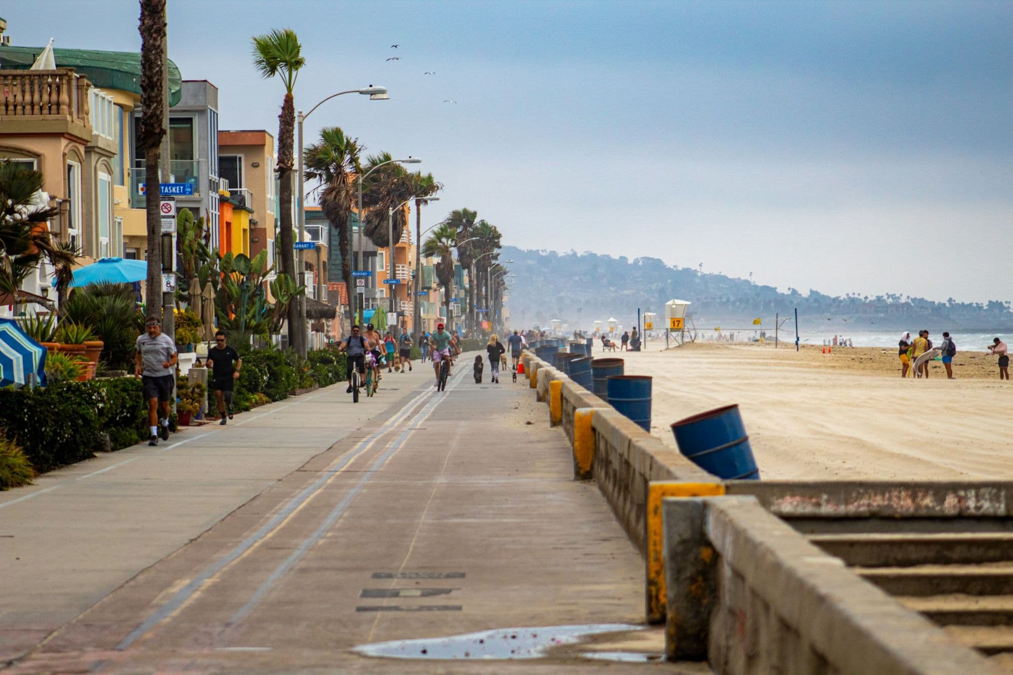
The home stretch into Los Angeles. Start with a relaxed morning in Santa Barbara, drive the coast through Malibu, and end at the Santa Monica Pier, the classic finish line for a PCH drive. From there, you are on the edge of LA.
Santa Barbara's working wharf at the foot of State Street, the city's walkable main drag of cafes, shops, and tasting rooms. Walk out on the wharf for harbor views, then stroll up State Street for coffee or an early lunch. It is an easy, pleasant start before the drive, and you can keep it to an hour or stretch it if you are in no rush. From here it is roughly an hour and a half down to Malibu.
A small, dramatic Malibu beach with sea stacks, caves, and sandstone arches, reached by a steep stairway down the bluff. It is the prettiest beach stop on the LA end of the drive and worth the climb down, but the parking lot is tiny and fills fast, so come earlier if you can. Wear shoes you can handle stairs in. Plan 45 minutes to an hour. Santa Monica is about 30 minutes further south.
The classic finish line, the pier with its small amusement park and the official end of Route 66. Walk out over the water, ride the Ferris wheel if you want the photo, and take in the fact that you have driven the whole coast. It is touristy and crowded, but it is the right place to close out a PCH trip. Park once and walk the pier and the beach path.
From Santa Monica you are already in greater LA, so this is less a stop than a finish. Where you go next depends on your plans: downtown, Hollywood, the airport, or a hotel for the night. If you have a flight, build in a big buffer, because LA traffic is its own adventure and nothing like the open coast you just drove. Drop the rental, or keep it if LA is your next chapter
Planning a Pacific Coast Highway Road Trip (Gas, Lodging, and the Road Itself)
A few practical things make this drive go smoothly, and most of them come down to preparation before you hit the road.
Drive north to south. It is not just convention. Heading south puts you in the ocean-side lane, so the views are right out your window and the scenic pullouts are easy to turn into without crossing oncoming traffic. On a road this curvy, that matters.
Fill up before Big Sur. Gas stations through the Big Sur stretch are few and far between, and they charge a steep premium when you find them. Top off the tank in Monterey or Carmel before you head south, and do not let it run low on the cliffs. Cell service is also unreliable through much of Big Sur, so download offline maps and your lodging confirmations ahead of time rather than counting on a signal.
Book your coastal nights early. Lodging in Carmel and Big Sur is limited and expensive, and it sells out well in advance, especially on weekends, when many places require a two-night minimum. This is the one part of the trip you cannot wing.
Check Highway 1 conditions before you leave. The Big Sur coast is one of the most landslide-prone stretches of road in the western United States, and sections of Highway 1 close for slides and storm damage more often than any other part of the route, sometimes for long stretches. Closures and detours change with the seasons, so check the current status with Caltrans before your trip and again the morning you drive Big Sur. Plan around whatever is open that week rather than assuming the whole road is clear.
Take the curves slowly. Big Sur is winding and there is no rushing it, nor any reason to. Use the pullouts to let faster locals pass, stop often, and give the slowest day of driving the most time. The road is the attraction, not an obstacle between attractions.
Where to Spend Each Night
Where you sleep shapes the pacing of this trip, so it is worth planning the four nights deliberately.
Nights 1 and 2: Monterey or Carmel. Base yourself on the Monterey Peninsula for the first two nights and you handle Day 1 and Day 2 without changing hotels. Monterey is more practical and has more options at every price; Carmel is prettier and pricier. Either way, you start Big Sur fresh on the morning of Day 3, which is exactly what you want for the slowest, most scenic stretch.
Night 3: Big Sur, or push south to Cambria / San Simeon. This is the real decision. Sleeping in Big Sur itself means waking up among the redwoods and the coast, but rooms are limited, expensive, and book out far ahead. Pushing south to Cambria or San Simeon is cheaper, easier to book, and puts you within minutes of Hearst Castle and the elephant seals for an early Day 4 start. If Big Sur lodging is full or out of budget, the southern option is the practical pick and barely costs you on Day 4.
Night 4: Santa Barbara. Santa Barbara is the natural last-night base before LA. It is a relaxed,
walkable coastal city with plenty of lodging, and it leaves you a short, easy final day down through Malibu to Santa Monica.
If you want to simplify, the cleanest version is two nights on the Monterey Peninsula, one night in Cambria or San Simeon, and one night in Santa Barbara. Book the Monterey/Carmel and Big Sur-area nights first, since those are the ones that sell out.
That is the drive: five days, north to south, each day picking up where the last one ended so you keep moving down the coast. Treat it as a frame, not a rulebook. If you fall hard for the Monterey Peninsula, give it a second night and start Big Sur fresh. If you would rather sleep in Big Sur itself to wake up over the ocean, the lodging section below lays out that trade-off.
The two things worth sorting before you pull out of San Francisco: check the Caltrans conditions for Highway 1 through Big Sur, and book your coastal nights early, because Carmel and Big Sur rooms are limited and go fast. Do those two and the rest of the trip mostly takes care of itself.
If this is the route you want, copy the whole thing to your own map in one tap and start shaping it into your real trip. Swap in the seafood place a friend swears by, add the brewery you saw in Santa Barbara, push a day longer in Big Sur. That is what turns a guide into your own itinerary.